

Many pictures, maps and items that prove Vietnam’s sovereignty over Hoang Sa Archipelago (Paracel Islands) several centuries ago are preserved at the Museums of Quang Ngai province and Danang city.
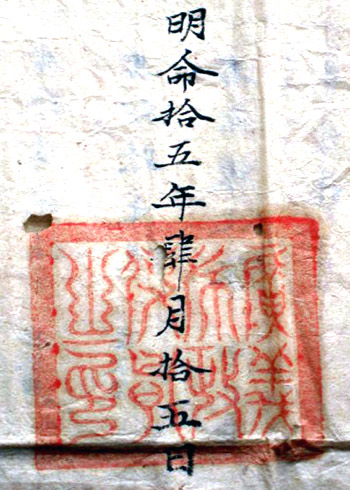
The order of Quang Ngai province’s governor on sending boats and soldiers to
Paracel Islands under the court’s instruction in 1834.
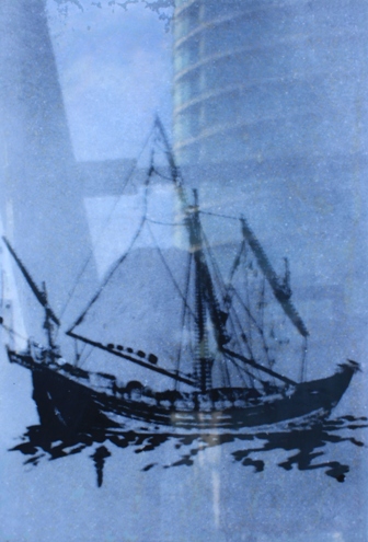
A boat of the Hoang Sa flotilla in the 17th and 18th centuries.
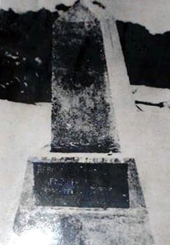
Vietnam’s sovereignty stele on Paracel Islands in 1930.

A radio transmitter-receiver station on Paracel Islands in 1939.
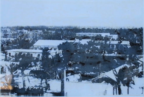
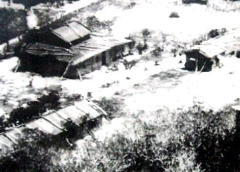
Administrative office on Paracel Islands under the French rule.
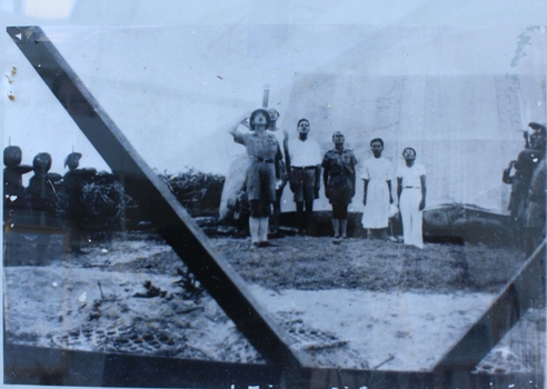
Vietnamese soldiers salute the flag on Paracel Islands.
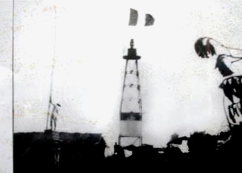
Vietnam’s lighthouse on Paracel Islands before 1945.
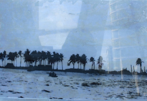
Duy Mong island (in Paracel Islands) before 1945.
The office of the Saigon Regime on Paracel Islands before 1974.
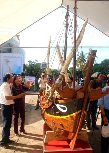
The model boat of the Hoang Sa flotilla in the 17th-19th centuries.
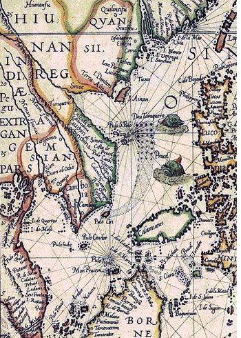
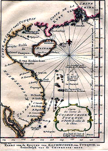
A Vietnam map drawn by Dutch experts in 1594, which clearly points out
that Paracel Islands belongs to Vietnam.
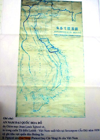
A Vietnam map drawn by French bishop Taberd in 1838 with accurate
co-ordinates of Vietnam’s Paracel Islands.
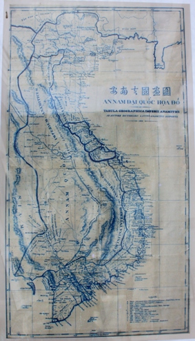
This is a valuable document proving Vietnam’s sovereignty
over the Paracel Islands.
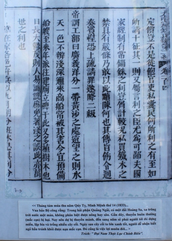
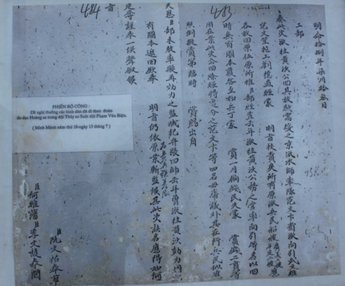
King Minh Menh’s document dated 1833, which confirmed that the Paracel
Islands is part of Vietnam’s Quang Ngai province.
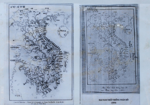
A Vietnam’s map drawn under the Nguyen dynasty in the early 19th century, which notes that
the Paracel Islands and Truong Sa (Spratly Islands) belong to Vietnam.
A map of Vietnam’s coast and islands in the historical book of the Nguyen Dynasty in
the 19th century, which notes that La Paracel (Hoang Sa) belongs to Vietnam.
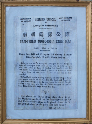
King Bao Dai’s instruction in 1938 on the merging of the Paracel
Islands into Thua Thien province.
The captain of the Hoang Sa flotilla’s document on measurement data of the
Paracel Islands in the early 19th century.
Leave your comment on this story